Located approximately 81 kilometers from Saigon’s city center you need a little over 2 hours to get there by motorcycle, using a ferry for 6k VND on the way. The four color coded hiking trails are easy to find:
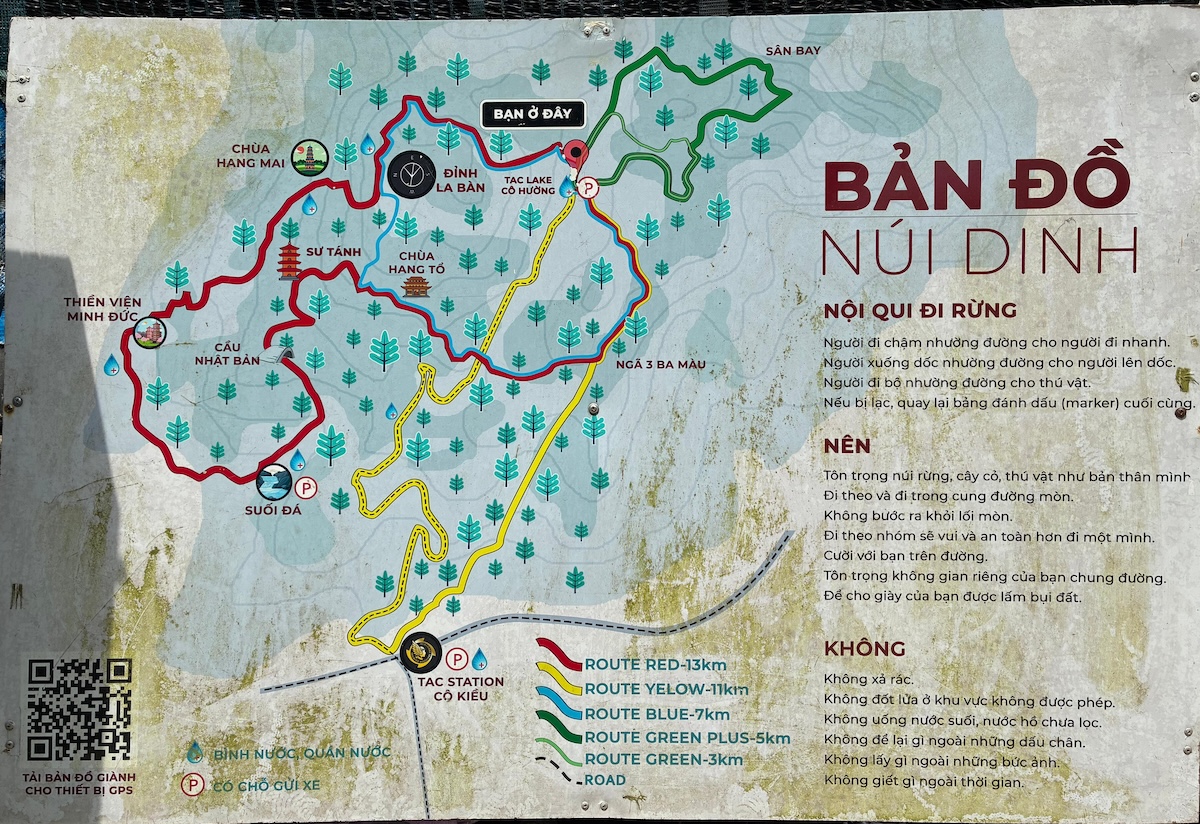
Red route
It states 13 kilometers on the map. My GPS on Núi Dinh II measured 15 kilometers. The tour itself will take less than 4 hours, but with some breaks a time of 5-6 hours is easily to be achieved. It was actually the first route we took Núi Dinh I in 2023-11-26, but we took the shortcut on the last part and walked on the road, following the yellow route. Untrained it took us 6 hours.
Blue route
This is a great alternative to the red route, since it has the same starting point and also includes the highest point. If you realize that your group is not strong enough for the long journey, you want to take it easier or you started later and don’t want to rush, you can after 3 kilometers decide to just walk the shorter blue route. On the map indicated as 7km we actually walked 8.12 km on 2026-02-24 with Núi Dinh III. Walking time was 3h30, but with breaks we spent 5h25 in nature.
History
- Núi Dinh I - 2023-11-26 with 5 friends, red route in more than 6 hours
- Núi Dinh II - 2025-07-07 finally finish red route 15 km in less than 4 hours
- Núi Dinh III - 2026-02-24 with 3 friends
- Núi Dinh IV - 2026-10-11 with members from 3 congregations